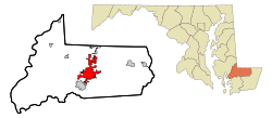
Salisbury, Maryland
| City of Salisbury | |||
|---|---|---|---|
| — City — | |||
 |
|||
|
|||
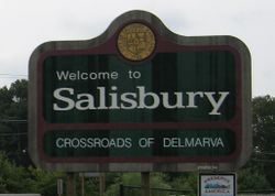
| Nickname(s): The Crossroads of Delmarva | |||
 |
|||
| Coordinates: | |||
| Country | United States | ||
| State | Maryland | ||
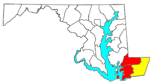
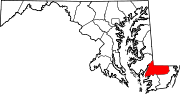
| County | Wicomico | ||
| Founded | 1732 | ||
| Incorporated | 1854 | ||
| Government | |||
| - Type | Strong-mayor | ||
| - Mayor | Jim Ireton (Democrat) | ||
| - City Council |
Member List
|
||
| Area | |||
| - City | 11.4 sq mi (29.6 km2) | ||
| - Land | 11.1 sq mi (28.7 km2) | ||
| - Water | 0.4 sq mi (0.9 km2) 3.18% | ||
| Elevation | 26 ft (8 m) | ||
| Population (2000) | |||
| - City | 23,743 | ||
| - Density | 2,145.5/sq mi (828.1/km2) | ||
| - Metro | 109,391 | ||
| 2000 CSA pop'n. 155,934 | |||
| Time zone | Eastern (UTC-5) | ||
| - Summer (DST) | Eastern (UTC-4) | ||
| ZIP codes | 21801-21804 | ||
| Area code(s) | 410, 443 | ||
| FIPS code | 24-69925 | ||
| GNIS feature ID | 0591221 | ||
| Website | www.ci.salisbury.md.us | ||

Salisbury (/ˈsɔlzbəri/) is a city in southeastern Maryland, United States. It is the county seat of Wicomico County, Maryland[1] and the largest city in Maryland's Eastern Shore region. The city's population was 23,743 at the 2000 census. Salisbury is the principal city of the Salisbury, Maryland Metropolitan Statistical Area, which is part of the Salisbury-Ocean Pines, Maryland Combined Statistical Area. The city is the commercial hub of the Delmarva Peninsula and is sometimes called "the Crossroads of Delmarva".
Salisbury is located near several major cities: Baltimore 106 miles (171 km); Washington, D.C. 119 miles (192 km), Philadelphia 128 miles (206 km), Norfolk 132 miles (212 km), Dover 50 miles (80 km), and Wilmington 96 miles (154 km).
Contents |
History
Salisbury's location at the head of Wicomico River was a major factor in growth. At first it was a small colonial outpost of Lord Baltimore's. The river was the only navigable waterway leading out to the Chesapeake Bay for early settlers. In 1732, Salisbury became an official port, growing to be second only to Baltimore as the most active seaport in Maryland.
Geography
Salisbury is located at (38.365806, -75.593361)[2].
According to the United States Census Bureau, the city has a total area of 11.4 square miles (29.6 km²), of which, 11.1 square miles (28.7 km²) of it is land and 0.4 square miles (0.9 km²) of it (3.15%) is water. The city has varying elevation of 17 – 45 ft.
Climate
Salisbury's location on the Atlantic Coastal Plain in Maryland gives it a Humid subtropical climate, with hot, humid summers and cool to mild winters.. In July, the average high is 87 °F, the average low 68 °F. In January, the average high is 46 °F, with average low of 28 °F[3]. Annual precipitation of 47.04 in of rain, and 11 in of snow [4].
| Monthly Normal and Record High and Low Temperatures | ||||||||||||
| Month | Jan | Feb | Mar | Apr | May | Jun | Jul | Aug | Sep | Oct | Nov | Dec |
|---|---|---|---|---|---|---|---|---|---|---|---|---|
| Rec High °F (°C) | 77 (25) | 77 (25) | 88 (31) | 95 (35) | 97 (36) | 101 (38) | 101 (38) | 100 (38) | 97 (36) | 95 (34) | 86 (30) | 78 (26) |
| Norm High °F (°C) | 46 (8) | 49 (9) | 57 (14) | 67 (19) | 75 (24) | 83 (28) | 87 (31) | 85 (29) | 80 (27) | 70 (21) | 60 (16) | 50 (10) |
| Norm Low °F (°C) | 28 (-2) | 30 (-1) | 37 (3) | 45 (7) | 54 (12) | 63 (17) | 68 (20) | 67 (19) | 60 (16) | 48 (9) | 40 (4) | 32 (0) |
| Rec Low °F (°C) | -5 (-21) | 2 (-17) | 9 (-13) | 22 (-6) | 32 (0) | 41 (5) | 46 (8) | 45 (7) | 35 (2) | 26 (-3) | 14 (-10) | -4 (-20) |
| Precip in (mm) | 4.02 (102.1) | 3.45 (87.6) | 4.55 (115.6) | 3.34 (84.8) | 3.67 (93.2) | 3.62 (91.9) | 4.54 (115.3) | 4.72 (119.9) | 3.99 (101.3) | 3.43 (87.1) | 3.17 (80.5) | 3.47 (88.1) |
| Source: Weather.com [1] | ||||||||||||
Demographics
Salisbury is the principal city of the Salisbury-Ocean Pines CSA, a Combined Statistical Area that includes the Salisbury metropolitan area (Somerset and Wicomico counties) and the Ocean Pines micropolitan area (Worcester County),[5][6][7] which had a combined population of 155,934 at the 2000 census.[8]
As of the census[8] of 2000, there were 23,743 people, 9,061 households, and 4,802 families residing in the city. The population density was 2,145.5 people per square mile (828.1/km²). There were 9,612 housing units at an average density of 868.6/sq mi (335.2/km²). The racial makeup of the city was 60.71% White, 32.32% African American, 0.23% Native American, 3.19% Asian, 0.03% Pacific Islander, 1.47% from other races, and 2.06% from two or more races. Hispanic or Latino of any race were 3.39% of the population.
There were 9,061 households out of which 27.4% had children under the age of 18 living with them, 30.4% were married couples living together, 18.2% had a female householder with no husband present, and 47.0% were non-families. 33.5% of all households were made up of individuals and 12.2% had someone living alone who was 65 years of age or older. The average household size was 2.36 and the average family size was 3.00. In 2005, 324 new single family homes were built, with an average value of $119,358.
In the city the population was spread out with 21.8% under the age of 18, 21.8% from 18 to 24, 26.9% from 25 to 44, 17.0% from 45 to 64, and 12.5% who were 65 years of age or older. The median age was 29 years. For every 100 females there were 87.2 males. For every 100 females age 18 and over, there were 82.9 males.
The median income for a household in the city was $29,191, and the median income for a family was $35,527. Males had a median income of $26,829 versus $21,920 for females. The per capita income for the city was $15,228. About 16.5% of families and 23.8% of the population were below the poverty line, including 28.9% of those under age 18 and 10.2% of those age 65 or over.
As of the census of 2008, there were 28,200 people in Salisbury with a population change of + 18.8%.
Government
Salisbury is a municipality within Wicomico County. The form of government is strong-mayor, as defined by the City Charter. In this form, executive functions are vested in a popularly elected mayor who serves a four-year term; currently Jim Ireton. He is responsible for overseeing the Building Permits & Inspections, Internal Services, Fire, Neighborhood Services and Code Compliance, Police, and Public Works departments. Most day-to-day functions are managed by the city administrator. Legislative and oversight functions are the purview of the elected council. The five council members are elected to four-year terms from the city's two districts. City elections are non-partisan. Council meets in regular session the second and fourth Monday of each month in Council Chambers. Council work sessions are held the first and third Monday of each month.
City government is housed at Government Office Building (GOB) at the intersection of West Church Street and North Division Street, downtown. The facility is shared by Salisbury and Wicomico County. The city and county also maintain a joint Planning and Zoning department.
Mayors of Salisbury[9]
| Name | From | To |
|---|---|---|
| A. G. Toadvine | 1888 | 1890 |
| Thomas Humphreys | 1890 | 1894 |
| Randolph Humphreys | 1894 | 1898 |
| Jehu T. Parsons | 1898 | 1900 |
| C. R. Disharoon | 1900 | 1904 |
| Charles E. Harper | 1904 | 1910 |
| William F. Bounds | 1910 | 1912 |
| B. Frank Kennerly | 1912 | 1914 |
| William F. Bounds | 1914 | 1916 |
| I. E. Jones | 1916 | 1920 |
| W. Arthur Kennerly | 1920 | 1924 |
| L. Thomas Parker, Sr. | 1924 | 1928 |
| Wade H. Insley, Sr. | 1928 | 1934 |
| E. Sheldon Jones | 1934 | 1936 |
| Alfred T. Truitt, Sr. | 1936 | 1938 |
| Arthur W. Boyce | 1938 | 1940 |
| Virgil Hitchens | 1940 | 1946 |
| E. R. White, Jr. | 1946 | 1950 |
| Rollie W. Hastings | 1950 | 1958 |
| Jeremiah Valiant | 1958 | 1959 |
| Boyd E. McLernon | 1959 | 1962 |
| Frank H. Morris | 1962 | 1966 |
| Dallas G. Truitt | 1966 | 1974 |
| Elmer F. Ruark | 1974 | 1982 |
| W. Paul Martin | 1982 | 1998 |
| Barrie Parsons Tilghman | 1998 | 2009 |
| James P. Ireton, Jr. | 2009 | - |
All-America City Award
On June 18, 2010 Salisbury received the All-America City Award.[10] The National Civic League awards communities that have addressed issues in an innovative way, in partnership with public, private, and nonprofit groups.
The City received the award for three projects:[11]
- The revitalization of Rose and Lake Street neighborhoods in partnership with nonprofit organization Salisbury Neighborhood Housing, Inc, the State of Maryland, Parkside High School CTE program, Hebron Savings Bank, and a grant from the Community Foundation of the Eastern Shore.
- The Youth Leadership Academy which developed leadership in students in grades 8-11.[12]
- Homeless initiatives including the Code Blue Shelter operated by nonprofit organization Hope And Life Outreach (HALO) with assistance for veterans from nonprofit NATRA, Inc., which provides counseling services.
Economy and businesses
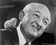
Perdue Farms, a multi-national poultry corporation, is headquartered in Salisbury. Other industries in Salisbury include electronic component manufacturing, pharmaceuticals, shipbuilding, and agriculture.
Some of the major employers in Salisbury include: Salisbury University, Verizon, Peninsula Regional Medical Center, and Pepsi Bottling of Delmarva. Peninsula Regional Medical Center employs more Salisbury residents than any other company, while Perdue Farms is the largest employer headquartered in Salisbury (with a total employment greater than the population of the City of Salisbury). The labor market within 15 miles of Salisbury is 85,000, and at a 30 mile radius 101,000 people.
Piedmont Airlines, a regional airline, is headquartered in unincorporated Wicomico County,[13] on airport grounds near Salisbury.[14]
Education
Public schools are under the jurisdiction of Wicomico County Public Schools. The city is home to numerous educational facilities. It boasts three high schools, three post secondary institutions, and numerous elementary and middle schools. Additionally, several private institutions maintain academic programs in the city.
Post secondary: Salisbury University is located off U.S. 13 Business in the University-South Neighborhood; Wor-Wic Community College is located off U.S. 50 East outside of Salisbury near Winterplace; Sojourner Douglass College is located in East Salisbury on Truitt Street.
Secondary: Salisbury Baptist Academy, James M. Bennett High School; Parkside High School; Wicomico High School; Salisbury Middle School; Wicomico Middle School; Bennett Middle School; Salisbury Christian School; The Salisbury School; Faith Baptist School.
Elementary: Chipman; Glen Avenue; North Salisbury; Westside Intermediate; Pinehurst; Pemberton; Prince Street; West Salisbury; East Salisbury; Wicomico Day School; The Salisbury School; Salisbury Christian School; St. Frances de Sales (Roman Catholic), Faith Baptist School.
Media
Periodicals
- The Daily Times
- Wicomico Weekly - weekly publication of the Daily Times
- Metropolitan Magazine - monthly magazine
- Delmarva Youth - bimonthly magazine
Radio
- W204AY - 88.7 FM - Religious
- WSCL - 89.5 FM - National Public Radio
- WDIH - 90.3 FM - Religious
- WICO - 92.5 FM - Talk
- WZBH - 93.5 FM - Rock
- WXSU - 96.3 FM - College
- WKTT - 97.5 FM - Country
- WSBY - 98.9 FM - Urban Adult Contemporary
- WWFG - 99.9 FM - Country
- WQHQ - 104.7 FM - Adult Contemporary
- WDKZ - 105.5 FM - Top 40
- WKHI - 107.7 FM - Country
- WTGM - 960 AM - Sports
- WICO - 1320 AM - Talk
- WJDY - 1470 AM - Traditional Pop
Television
- WBOC Channel 16, DT 21.1 CBS
- WBOC-DT2 (Fox 21 Delmarva) DT 21.2 Fox
- WMDT Channel 47, DT 53.1 ABC
- WMDT-DT2 (The CW 3 Delmarva) DT 53.2 The CW
- WCPB Channel 28, DT 58.1 & 58.2 PBS -- additional subchannels 58.3-58.5
- PAC 14 Public Access Channel 14 - Local Government & Public Interest (Comcast)
Culture
Salisbury is the largest city on Maryland's Eastern Shore. The calendar of annual events emphasizes the region's focus on the outdoors. Additionally, the city and county maintain numerous parks for residents to enjoy the natural beauty of the area. Scholars and performers associated with Salisbury University contribute greatly to quality of life.
Museums and other historic facilities offer a respite from daily hustle. These include: Salisbury University Arboretum; Salisbury Zoo; Ward Museum of Wildfowl Art; Arthur W. Perdue Stadium; Edward H. Nabb Center for Delmarva History and Culture; Chipman Cultural Center; Poplar Hill Mansion; Port of Salisbury Marina; Wicomico Youth and Civic Center.
Salisbury and Wicomico County also maintain numerous parks within the metropolitan jurisdiction[15]. These parks include: City Park, Comfort Safety Zone Playground, Doverdale Park and Playground, Elizabeth W. Woodcock Park and Playground, Jeannete Chipman Playground (fully handicapped accessible), Lake Street Park and Playground, Newtown Park, Newtown - Camden Tot Lot Park and Playground, Waterside Park and Playground, Schumaker Pond, Pemberton Historical Park, Parker Athletic Complex, The River Walk.
Sports
Salisbury has a rich history of supporting baseball. The Eastern Shore Baseball League was headquartered there; two franchises—the Salisbury Cardinals and the Salisbury Indians -- called the city home. Today, the Delmarva Shorebirds represent the town in the South Atlantic League. The Eastern Shore Baseball Hall of Fame is housed at the Arthur W. Perdue Stadium. The Shorebirds are a Single-A Affiliate of the Baltimore Orioles.
Salisbury also is home to Division 3 Salisbury Seagulls. The Seagulls have been dominant in Football, Field Hockey, Baseball, and Lacrosse with Lacrosse winning multiple NCAA National Titles. Seagull Stadium hosts the university's football team while Maggs Gymnasium hosts the basketball team.
Salisbury also hosts the Wicomico Stallions, a minor league football team.
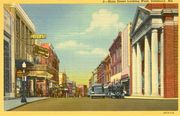
Cityscape
Salisbury's oldest neighborhoods boast Federal, Georgian, and Victorian architecture. The city also has rapidly expanding areas of town homes, sprawling suburbs, and big box strip malls. Each neighborhood attracts distinct demographics. Several 55 and older communities have been constructed in the last decade.
Neighborhoods:[16] Church St Area, Downtown, Harbor Pointe, Mt Hermon Rd, North End (Business), Park Area, Pinehurst, Smith St Area, Westside, Doverdale Area, Eastside, Johnson Lake Area, Newtown, North - Industrial, Princeton Area, Rt 13 South, University - South
Events
- Critical Mass - Second Wednesday of the month 5:30pm in front of Guerrieri University Center
- Victorian Tea - Each February at Poplar Hill Mansion
- Salisbury Festival - Held at End of April or Beginning of Spring by Salisbury Chamber of Commerce
- Pork in the Park - A three day Pork BBQ Festival, held the third weekend of April, at Winterplace Park
- Salisbury Community Band - Offers 6 summer concerts on Sunday evenings in June and July from the Bandstand at City Park
- Purnell-Thomas Memorial Tennis Tournament - Held each August at Salisbury University
- Sea Gull Century - Cycle 62 mi (100 km) or 100 mi (161 km) of Maryland's Eastern Shore each October. (hosted by Salisbury University)
- Autumn Wine Festival - Held the third weekend in October at Pemberton Park
- Christmas Parade - Held the first Sunday of each December, sponsored by the Salisbury Jaycees
- Yuletide Open House - Celebrate the holidays at historic Poplar Hill Mansion in Newtown each December
Organizations
Community participation through various groups fosters friendliness and betterment. Organizations that sponsor events within the city include: Salisbury Area Chamber of Commerce; The Salisbury Junior Chamber of Commerce (aka Salisbury Jaycees); Community Foundation of the Eastern Shore; Salisbury Chorale; Salisbury Community Band; Salisbury Symphony Orchestra; Wicomico Players; Peace Alliance of the Lower Shore. Several churches within the community also boast impressive musical programs, notably Wicomico Presbyterian Church and Asbury United Methodist Church.
Religion
Salisbury is home to Beth Israel Congregation, an egalitarian Conservative synagogue founded in 1925.[17] Other churches include: Faith Baptist Church, St. Francis De Sales Church, Trinity United Methodist Church, and Asbury United Methodist Church.
Sister cities
Transportation
Roads
Salisbury is served by two major highways—U.S. Route 13, one of the major north–south routes of the Delmarva Peninsula, and U.S. Route 50, one of the major east–west routes on the peninsula. US 13 connects Salisbury to Dover, Delaware and Norfolk, Virginia and is known as the Ocean Highway, while US 50 serves as the main route between the Baltimore/Washington region and many of the major cities on Delmarva, including Ocean City; it is known as the Ocean Gateway. US 13 and US 50 originally passed through the central business district, but have been subsequently rerouted onto the Salisbury Bypass, a 3/4 beltway around the city that allows through traffic on US 13 and US 50 to bypass the downtown area; earlier routes of both highways are now U.S. Route 13 Business and U.S. Route 50 Business. Earlier still, US 13 was routed along Division Street and US 50 along Main Street.
The city is also served by Maryland Route 12, a rural highway that connects Salisbury to the town of Snow Hill, and Maryland Route 349, a rural highway that connects Salisbury to Nanticoke and Quantico.
Air and sea
The city is served by daily scheduled commercial airline service at the Wicomico Regional Airport. Additionally, the Port of Salisbury offers respite for recreational boaters and commercial tug boats. Salisbury's navigable stop, on the Wicomico River, is the second largest and second busiest commercial port in Maryland.[18]
Public transportation
The city is also served by Shore Transit, which provides local bus service throughout the city, and also services points outside the city within the tri-county area, such as Ocean City's public transportation system. The major transfer point is on Calvert Street, in downtown Salisbury.[19]
Fares are $3 with no free transfers. Special discounts are given to senior citizens, and children under 42" ride free. Additionally, in July 2008, a seven-day pass was introduced for all riders.
As of December 2008, the transit system has 5 lines throughout the city:
- Route 22 Blue: West Salisbury
- Route 22 Green: Southeast Salisbury - access to Peninsula Regional Medical Center
- Route 22 Orange: North Salisbury - access to The Centre at Salisbury and Wal-Mart
- Route 22 Pink: South Salisbury and Fruitland - access to Wal-Mart
- Route 22 Purple: East Salisbury - access to Wor-Wic Community College
Shore Transit also connects to other points outside of the city:
- Route 1: Princess Anne, Westover, and Crisfield,
- Route 2: Princess Anne and Delmar
- Route 3: Princess Anne and Crisfield, limited service on Sundays only
- Route 11 and 21: Ocean City and Pocomoke City
Notable people from Salisbury
- Eric Brittingham, bass guitarist for Cinderella (band)
- James Cannon Jr., bishop for the Methodist Episcopal Church, born in Salisbury November 13, 1864.
- Ryan J. Davis, director & progressive activist
- Alexis Denisof, actor
- John Glover, actor
- Fernando Guerrero[20], professional boxer
- Linda Hamilton[21], actress
- William Humphreys Jackson, Maryland Congressman from 1901-1905 & 1907-1909.
- Bruce Howard, MLB pitcher with the Baltimore Orioles, Washington Senators, and Chicago Whitesox.
- Frank Perdue, businessman
- Jessica Lee Rose, actress who gained fame through the online soap opera, lonelygirl15 broadcast on YouTube
- Davis R. Ruark, Wicomico County State's Attorney
- Paul Sarbanes, U.S. Senator
- Mike Seidel, meteorologist at The Weather Channel since 1992
- Kevin Shaffer, NFL football player with the Chicago Bears.
References
- ↑ "Find a County". National Association of Counties. http://www.naco.org/Template.cfm?Section=Find_a_County&Template=/cffiles/counties/usamap.cfm. Retrieved 2008-01-31.
- ↑ "US Gazetteer files: 2000 and 1990". United States Census Bureau. 2005-05-03. http://www.census.gov/geo/www/gazetteer/gazette.html. Retrieved 2008-01-31.
- ↑ Weather Channel Monthly Temperature Averages for Salisbury, MD Retrieved March 28, 2009
- ↑ Salisbury, MD Climate Records National Weather Service.
- ↑ METROPOLITAN STATISTICAL AREAS AND COMPONENTS, Office of Management and Budget, 2007-05-11. Accessed 2008-08-01.
- ↑ MICROPOLITAN STATISTICAL AREAS AND COMPONENTS, Office of Management and Budget, 2007-05-11. Accessed 2008-08-01.
- ↑ COMBINED STATISTICAL AREAS AND COMPONENT CORE BASED STATISTICAL AREAS, Office of Management and Budget, 2007-05-11. Accessed 2008-08-01.
- ↑ 8.0 8.1 "American FactFinder". United States Census Bureau. http://factfinder.census.gov. Retrieved 2008-01-31.
- ↑ Maryland Manual On-Line - Salisbury Mayors. Retrieved April 24, 2009.
- ↑ Salisbury Named All-America City The Daily Times (Salisbury). Accessed 2010-06-19.
- ↑ All-America City 2010: Salisbury, Maryland’s presentation Accessed 2010-06-19.
- ↑ 2009 Youth Leadership Academy Held at SU Accessed 2010-06-19.
- ↑ "Career Opportunities." Piedmont Airlines. Retrieved on May 20, 2009.
- ↑ "About Piedmont." Piedmont Airlines. Retrieved on May 20, 2009.
- ↑ City of Salisbury Park List Retrieved March 27, 2008
- ↑ Salisbury Police Department Neighborhood Crime Statistics Retrieved on March 27, 2008.
- ↑ Wicomico County MD Council Minutes, June 20, 2006.
- ↑ DelmarvaNow.com - Dredging Funding Concerns Raised. Retrieved on April 18, 2009.
- ↑ Shore Transit Wicomico County Destinations. Retrieved on July 18, 2008.
- ↑ SaddoBoxing.com Spotlight - Fernando Guerrero. Retrieved April 18, 2009
- ↑ Bang, Steinar. "Internet Movie Database: Linda Hamilton - Biography". http://www.imdb.com/name/nm0000157/bio. Retrieved 2007-03-21.
- Richard W. Cooper, "History and Facts of Salisbury, Maryland."
- Poplar Hill Mansion[2]
External links
|
|||||||||||||||||||||||
|
|||||||||||||||||
|
||||||||||||||